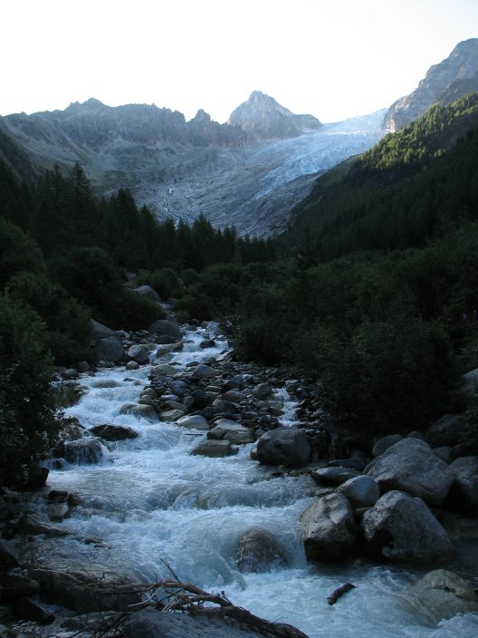
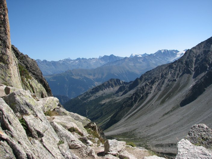
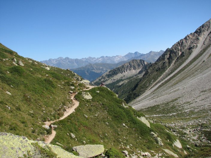
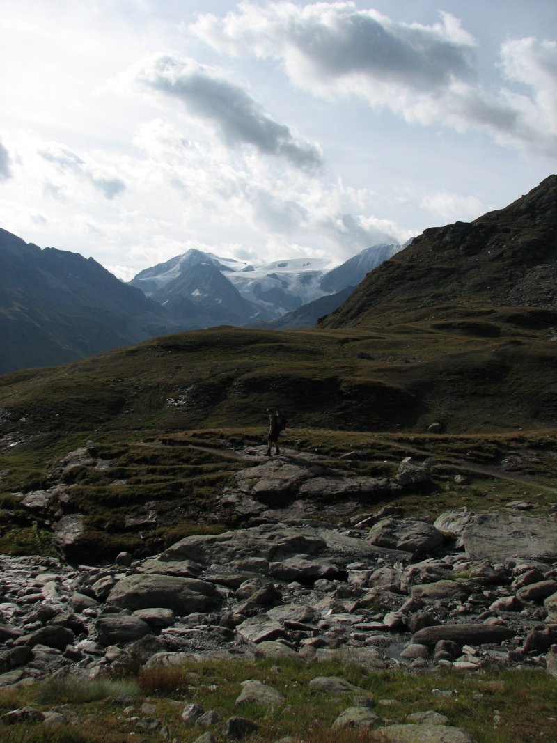
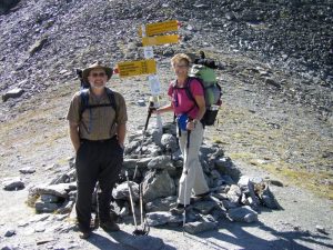
Introduction to “The 50 Trip” – Chamonix to Zermatt – Aug/Sept 2009

First of all – why?  Well, why not?  We wanted to make a big celebration of turning 50 this year, and what better way to do that than an amazing backpacking trip with the luxury of a warm bed and a bottle of wine at the end of the day?  Not to mention some pretty good food that we didn’t have to schlep around and prepare for ourselves.  I got the idea for this “50 trip” after a friend took the walking Haute Route several years ago.  It sounded ideal.

Continue reading “Introduction to “The 50 Trip” – Chamonix to Zermatt – Aug/Sept 2009″

Making Plans: Accommodations and Travel within Switzerland

GETTING TO CHAMONIX

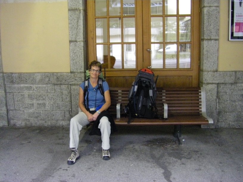
We took flights to Geneva and then booked a shuttle to take us down to Chamonix.  There were tons of shuttle services available, and many that you could book online.  It seemed that the price was pretty similar from one outfit to another.  We booked with Mountain Dropoffs through the internet, and were very pleased with their service.  They emailed us several times with confirmation numbers and contact information.  The driver met us at the airport with our name on a whiteboard to locate us.  We had to wait a bit for another flight and group of travelers, but we were prepared for that.  The drive to Chamonix took about an hour and the shuttle took us directly to our hotel door.  I think it is wise to book this ahead of time since there will always be a huge bolus of people arriving at once, leading to long lines at transportation services.

ACCOMMODATIONS AND MEALS

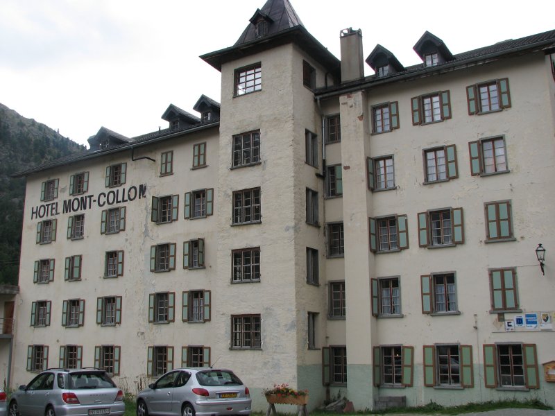
Originally I was willing to shed my usual (anal?) routine of making reservations for each night of the trip.  I wanted to allow some flexibility, and to show that I could be more spontaneous in my old age.  Then I thought, who am I kidding?  I have made all these plans and I expect that I’ll want to stick to them…  So much for spontaneity!  And after the fact, I’m glad that I did make reservations, because we would have been in trouble more than a few nights.  If you do decide to wing it – you will find that all but the smallest of towns have a tourist office that can help you find a place to stay.  We ended up making one change to our route along the way, after learning about a trail wash-out, and we took advantage of the Office du Tourisme in St. Niklaus to find a hotel for the night.  They asked what kind of accommodation we were looking for (hotel or hostel/dortoir) and then called to confirm availability.  Very easy!

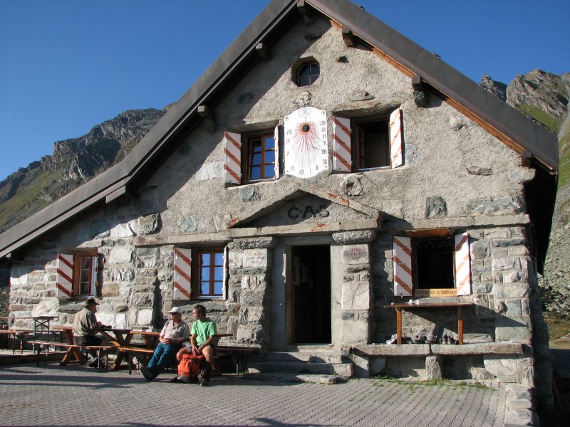
We planned to arrive in Geneva on Thursday morning, August 27, spending 2 nights in Chamonix before starting the trek on Saturday the 29th, and then ending in Zermatt on the 8th of September.  From there we planned to take a train to Basel and then back to Geneva for our flight home on Sept. 12.  I sat down on the 4th of July and was able to make most reservations either online or via email over the next few weeks.  In some cases we could book directly with a hotel, in others we had to go through some kind of travel intermediary.  We’ll go into more details as we journal the trip and talk about where we stayed.  We never did make any confirmations with the Europa Hut – and that ended up being the one place we didn’t make it to.  Hmm – karma?  There was one hut that we had to call by phone to make a reservation – Cabane de Prafleuri.  My husband ended up calling from work because he has a co-worker who speaks French.  However, once on the line, when he asked “Parlez vous anglais?” she immediately switched to English and the transaction was completed without difficulty.

Many of the people that we met along the way did not make reservations ahead of time.  If you are willing to be flexible and hike to another town or stay in a cheaper or more expensive place than you had planned, you will most likely be able to have a bed each night.  Surprisingly, while I expected the mountain huts to be more accommodating and make space in a pinch, we did have friends (met along the way) who ended up having to travel another couple of hours (and more than a few meters) to a more distant and remote (read “higher elevation”) hut when the one they were counting on was full for the night!  I would recommend making reservations at the more remote areas with fewer options or smaller facilities.  We were surprised to discover a huge group of people at Cabane de Prafleuri (a private party of Swiss Alpine Club friends and family) and might not have been able to stay there if we hadn’t booked it in advance.  That was a particularly long day for us, and I can’t imagine having to hike further to Cabane des Dix (the closest option).

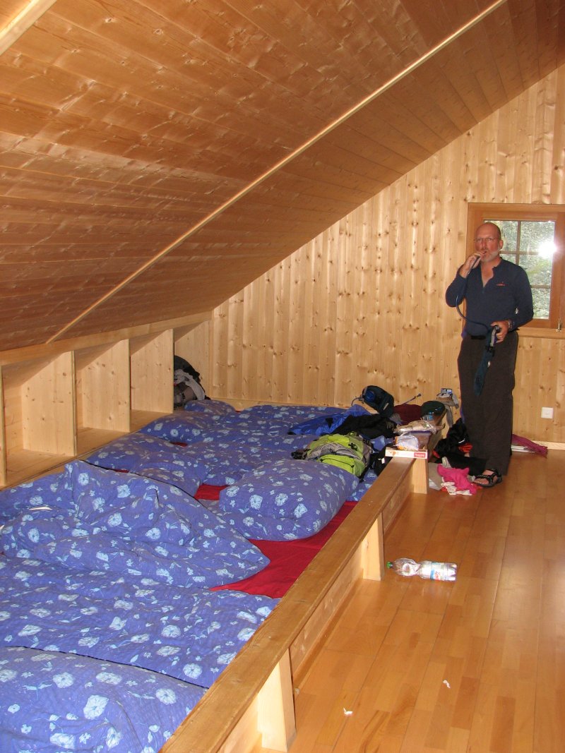
In smaller dortoirs and the mountain huts, be prepared to pay in cash.  We had no trouble finding ATMs in the larger towns along the way, so plan ahead and make sure you have enough to make it through to the next larger stop.  Also, at the mountain huts, it will cost you extra to take a shower.  Not necessarily a big deal, but don’t be surprised.  Typically you will buy a certain number of minutes; it is surprising how fast you can take a good shower!  We were able to “share” a shower at Prafleuri because when you’re buying minutes of water, you can shut it off while you soap up, then turn it back on to rinse off.

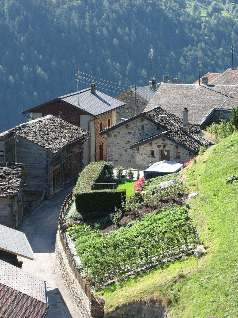
A word about hotels versus dortoirs and demi-pensions (half-boards) versus petit dejeuners (breakfasts).  Many of the blogs that we looked at ahead of time emphasized a frugal approach to the trip.  We were able to focus less on cost and more on comfort, so we investigated other options in each town, and we’ll let you know about those in the trip report.  In some cases, you won’t have any or much choice, in other towns, you’ll have a number of places to look at.  We tended to choose hotels when they were available, opting for privacy but losing out on meeting other people.  Think about that when you plan your trip.  One of the rewarding aspects of this route is that it is well-used by people from around the world.  In a way, it was good that a dortoir (in Trient) and two mountain hut nights (Mont Fort and Prafleuri) occurred early in our trip, because we were able to meet others who we kept running into over the next week.  Occasionally we would hike with friends we made or would meet up for a beer later on in the evening (a good option when your paces are quite different!).

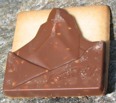
Once we left Chamonix, I think we stayed at only one hotel (in Champex) that did not include breakfast (petit dejeuner) with the cost of lodging.  Every place else had at least some sort of spread laid out in the morning.  The least impressive morning meal of the trip was served at Cabane du Mont Fort, while many of the hotel breakfast buffets could not be described as “petite” in any way.  The common theme was an assortment of breads, cheeses, thinly sliced ham – and chocolate!  The Swiss don’t save chocolate for dessert.  [Barry kept choosing croissants that looked like they should have cinnamon inside; he was always disappointed when it was chunks of chocolate instead.]  Sometimes there were eggs, juice and fruit.  Always there was tea, coffee and cocoa.  We found the best value for the evening meal was to choose the demi-pension, if it was available.  When we compared to other restaurants in the area, we could usually get a 3 course meal for the cost of just the entree elsewhere.  Typically there would be a meal of the day – often involving pork, so be careful if you have dietary restrictions.  There would be 3-4 courses: usually salad, sometimes soup; a main course; then a dessert.  I only had one dinner that I really didn’t like (at Hotel Schwarzhorn in Gruben) but I also didn’t feel great that evening.  The food did tend to get monotonous after awhile.  As I just mentioned, more remote villages often served pork and noodles.  Our lunches were typically bread, cheese, salami and then sometimes an apple or cookies with chocolate.  Since that was also what breakfast usually involved, it got a little old.  Needless to say, by the time we reached Zermatt, we were looking for more variety.

A WORD OF CAUTION REGARDING TRIP TIMING

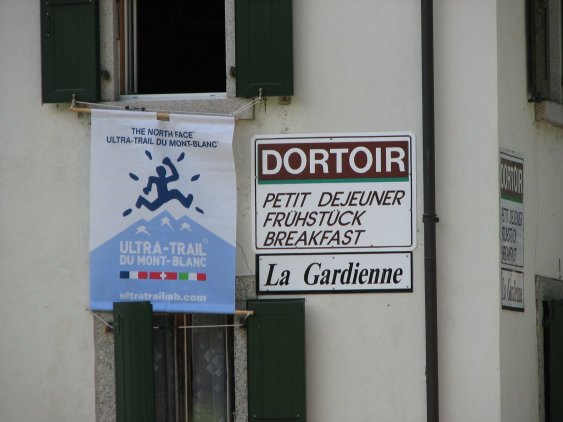
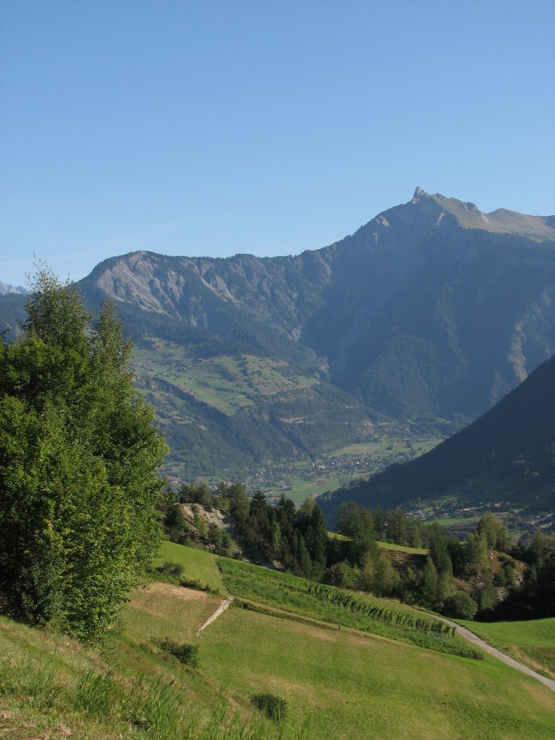
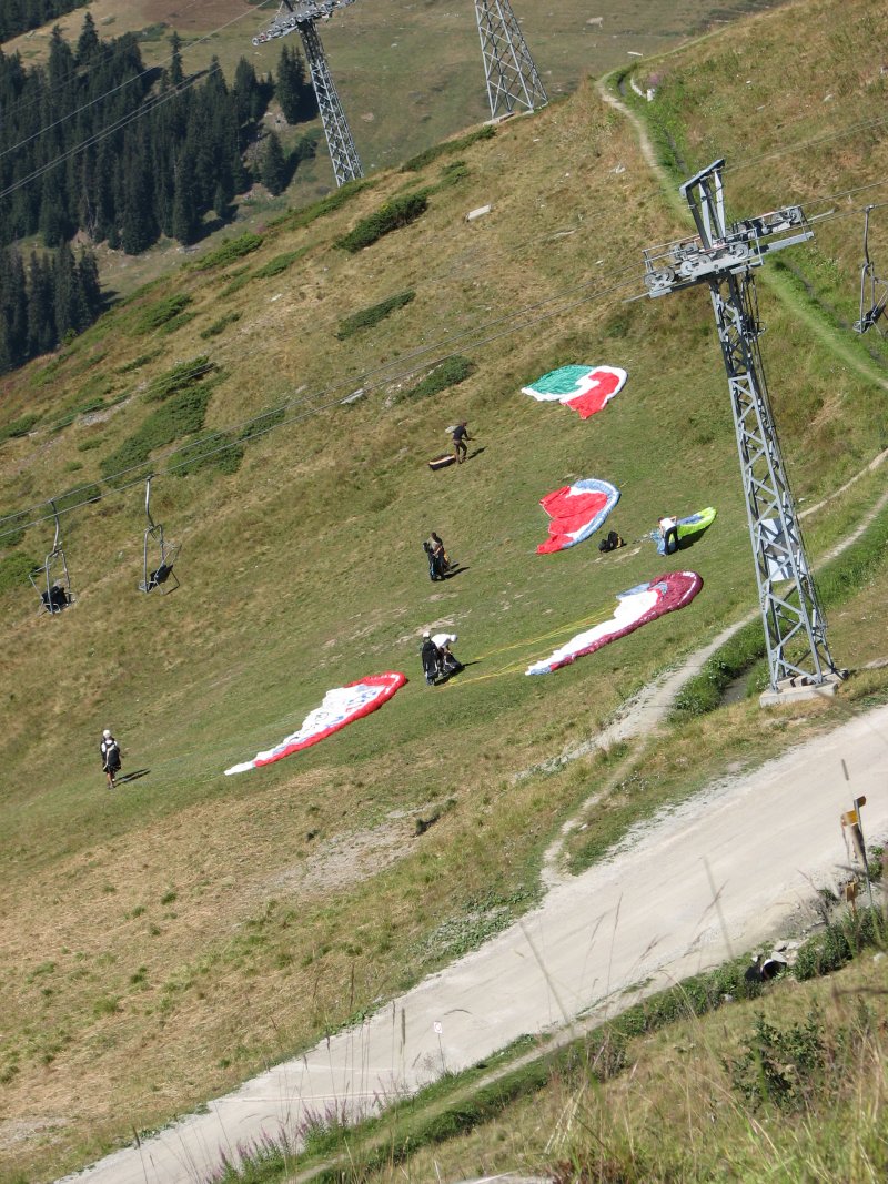
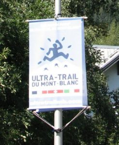
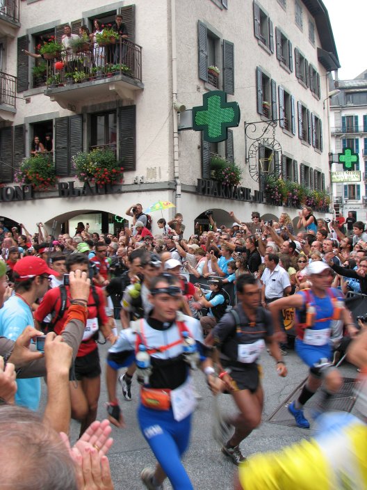
One unexpected barrier to finding space in a hotel/dortoir will be the numerous trail marathons that occur throughout the region in the summer.  We had anticipated a quaint resort village when we pictured Chamonix – instead we arrived to find a completely booked and bustling town filled with ultra-marathoners and their families!  Little did we know that the Ultra Trail du Mont Blanc was on – with insanely long races around the mountain that had started earlier in the week and  were continuing through the weekend.

Sign for the UTMB

There are a lot of accommodations in Chamonix, but I would bet that every bed in the valley was filled for that weekend.  So, you really should check ahead, not just for the UTMB, but about other races that are held throughout the Alps that may interfere with your trip.  There is a marathon from Sierre to Zinal in August that might make it harder to find a a place to stay in Zinal.

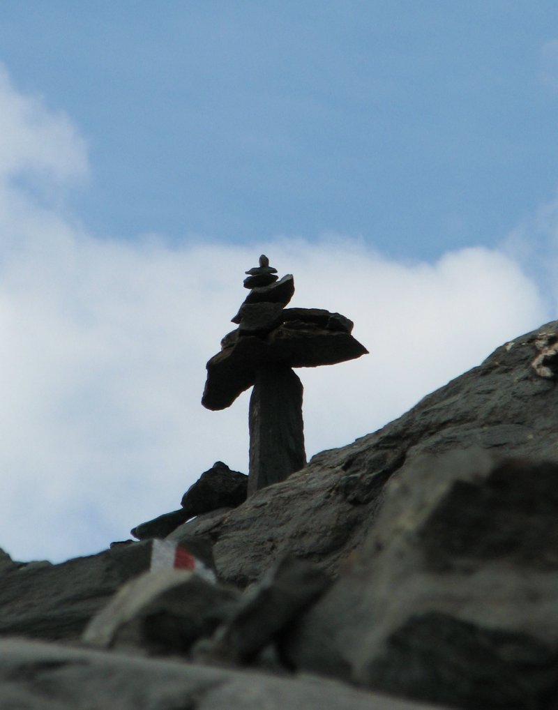
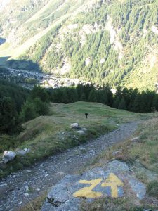
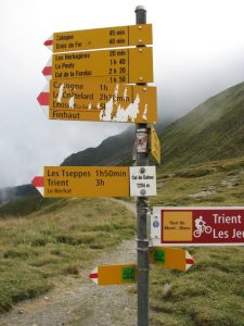
In fact, while leaving Zinal, you’ll see “Z” signs along the trail directing runners into the village.

When we reached Arolla, we found the town preparing for the end of another trail race – one that starts in Italy and follows the old smuggler’s trail into Switzerland, the Collon Trek.  Again, we lucked out that night, and in fact were one of just 2 groups staying at our hotel, but I think we would have had trouble if our trip had us reaching Arolla over the weekend.

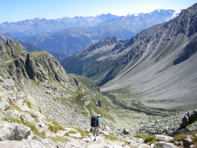
ALTERNATE FORMS OF TRAVEL – CABLE CARS AND CHAIR LIFTS

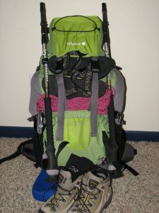
You may decide that you don’t really want to hike the entire route from one end to the other (believe it or not!).  We planned from the start to take any cable car (telepherique) or chair lift (telecabine) available along our route – hey we’re celebrating 50 – we’ve gotten smarter over the years!  But we weren’t smart enough to check schedules ahead of time, or to see if there were any bargains to be had for tickets.  Oh well – you’ll learn from our mistakes.

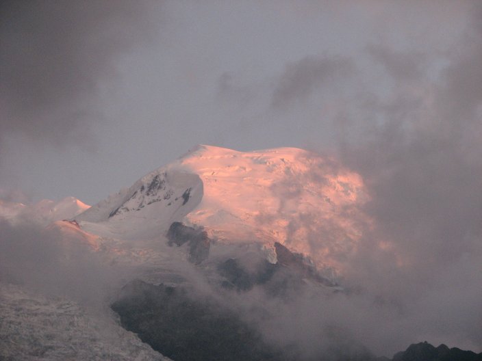
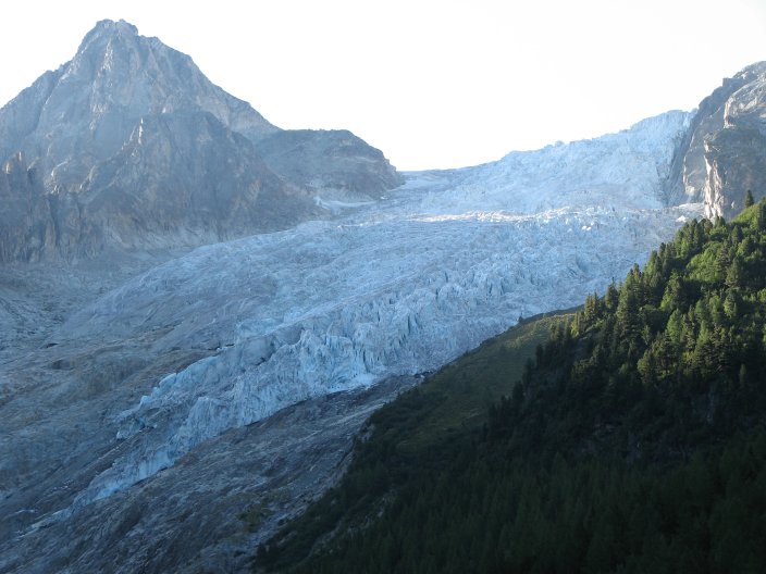
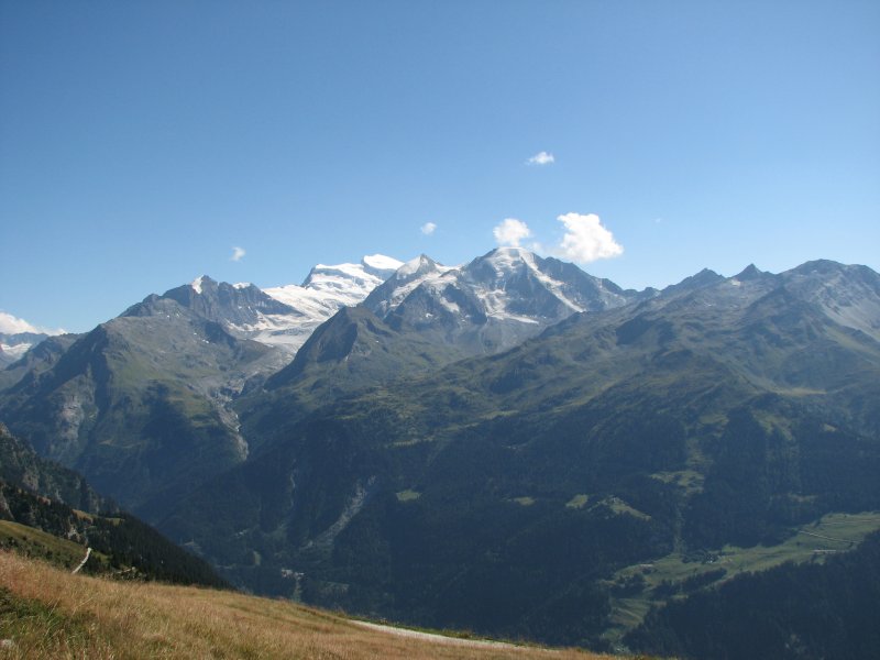
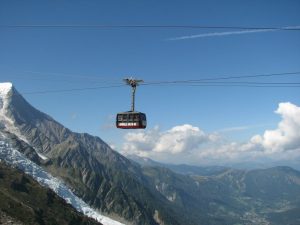
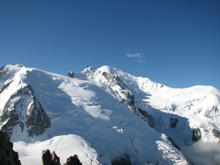
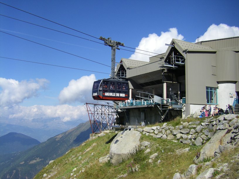
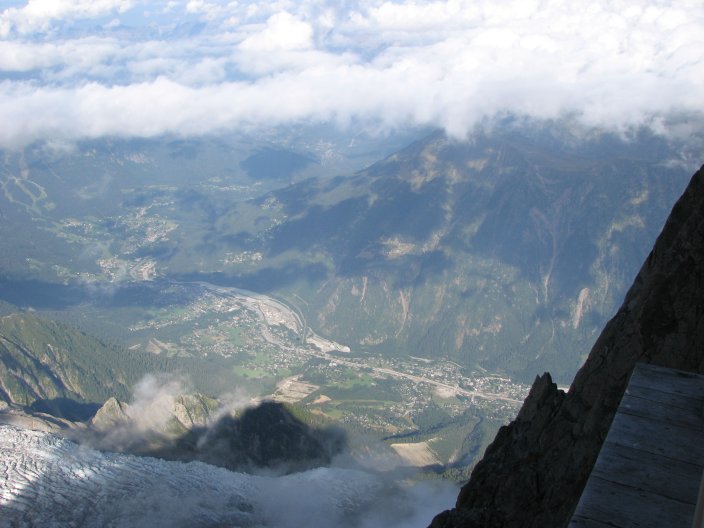
First of all, in Chamonix there are some fantastic cable car rides up to viewpoints on either side of the valley if you have the time and the money (they are not cheap, but are worth the fabulous views).  We found out later that we should have purchased a Mont Blanc pass, because even after we had started our trek, we could have used the pass for the first chair lift that we took from Le Tour to Col de Balme.  On the southern side of the valley above Chamonix are 2 cable car lifts to L’Aiguille du Midi (the Middle Needle) that offer close-up views of Mont Blanc.

Telepherique to L’Aiguille du Midi

The second planned cable car short-cut was from Le Chable to Les Ruinettes via Verbier.  This was where we discovered more important information missing from Kev’s book.  We arrived in Le Chable on Monday, August 31, only to discover that the cable car had stopped running the day before!  Damn!  The other little tidbit we learned this day was that the Swiss take a “siesta” in the afternoon, typically from noon to 2:00 or 3:00, so you can’t conduct any business during that time (except to eat at a restaurant).  Fortunately, we were able to take a bus to Verbier and the cable from Verbier to Les Ruinettes was still running.  Good thing, since there is no way that we could have made the hike up to Mont Fort that day.

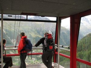
The other cable rides we took advantage of along the way were: Sorebois to Zinal and Jungen to St. Niklaus, both downhill trips that saved our knees.  The trail from Sorebois to Zinal would not have been that tough, in retrospect, but the descent from Jungen to St. Niklaus is crazy steep.  We used the tourist office to check that both of those cars were running (having learned our lesson in Le Chable).  These cables don’t run that frequently – every 30 or 60 minutes from Sorebois and the small car at Jungen basically runs as needed, but both have a late-afternoon cut-off, so check the timing to avoid getting stranded.

Taking the telepherique from Sorebois to Zinal

Jungen – and a steep descent into St. Niklaus

ALTERNATE FORMS OF TRAVEL – TRAINS AND BUSES

We decided ahead of time to take the train from Chamonix to Argentiere before starting our trip because the trail basically follows the road, and it didn’t sound all that enticing.  We were happy to find out that if you spend the night in a hotel in Chamonix, you can get a pass that allows you to travel by bus or train for free within the entire valley during your stay.  They are trying to reduce car traffic in the region (and you’ll see why when you are there!).

Midway through the trip, we needed to take a break from hiking to help Barry’s blisters heal before moving on.  We found that we could take a bus from Arolla to Sion, then a train from Sion to Sierre, and then another bus from Sierre to Grimentz, our next planned stop on the way.  Our hotel host in Arolla was fantastic in finding out schedules for us, but failed to realize that we could have purchased a 3-day pass that again would have saved us a lot of money, particularly because we also took the bus from Grimentz up to Barrage du Moiry the next day.

One last bit of info:  Before our trip, I bought rail passes (online) from Zermatt to Basel and from Basel to Geneva (we visited a friend in Basel at the end of our hike).  It was completely unnecessary to make those purchases ahead of time.  It didn’t save us any money and we could have easily bought tickets when we were there.  So, my recommendation is to wait on train tickets, you’ll have more flexibility if you need to change things up.

Getting Started – What you need

There are some essential items that you will need for your trip.

GUIDE BOOK

As I said before, the Kev Reynold’s book Chamonix to Zermatt, the Classic Walker’s Haute Route is an absolute necessity.  With this in hand, you probably don’t need to buy extra maps, although we found them useful in giving a bigger picture and showing alternate trails.  Kev is very specific in his directions, and takes pains to update the description with new editions.  That being said, make sure that you have the latest version!

There are tons of trails all over the Alps, and the Alpine Clubs do a great job of maintaining extensive signage.

You can usually tell where you are and where you need to go, and Kev’s descriptions are fantastic.  These yellow signs are at every junction, and when trails are over rocks or through towns, you will see blazes painted on rocks and buildings to help direct you along the way.

Throughout this account you will notice that we have some disagreements with “Kev time” – the amount of time the guide book tells you it will take to complete the hike.  He clarifies that this is just walking time – no breaks or lunch or stopping to take photos is counted.  I wish we had kept track of our timing, to provide another (slower) perspective that does include those necessary stops.  However, to be fair, his times were pretty similar to what was posted on the signs.  Neither seemed very realistic.   For example, one day Kev offers two alternatives to get from the Cabane de Prafleuri to Arolla – one is the route we took, over Col de Riedmatten (an adventure you’ll enjoy further on) or via Cabane des Dix and over the Pas de Chevres (involving ladders bolted into vertical rocks – no thanks!).  He suggests that it will take the same amount of time to do either one – 6.5 hours, and claims that the second route is just a kilometer longer.  Looking at the maps, and having been there and seen it, I can’t believe it!

So – whining aside – though it did often take us longer than the signs or the book suggested, we always made it to our final destination long before dark – and usually with an opportunity to rest and take a shower before supper.  Our latest arrival was still just around 6:30 in the evening.  We tended to have a more leisurely morning than most: usually on the road between 8:00 or 9:00 am, whereas most others were out the door between 7:00 and 8:00 am.

MAPS

If you are interested in having maps, you can find them online or wait to buy them in France and Switzerland.  We ordered maps ahead of time because I am just that type of person 🙂  We did see the same maps at tourist shops all along the route, but I’ll be honest that I didn’t check to see if each store had what we might have wanted at that particular stage of the journey.  Nothing in Switzerland is cheap, so I doubt that you would really save by waiting and purchasing maps once you got there.

You should be careful what you buy because the maps that you want have the letter “T” after the map number, indicating that trails are shown.  Without those, there isn’t much point in having them.  I found the maps at Omni Maps.  You will need all five maps in order see the entire route from Chamonix to Zermatt.  The maps are Martigny (282T), Arolla (283T), Montana (273T), Visp (274T) and Mischabel (284T).

EQUIPMENT

What you will need to purchase likely depends on whether you do much backpacking already.  However, if you haven’t done much hiking or other strenuous climbing activities, this is likely not the trip for you!  The first half of the route can be challenging – especially if you’re not into semi-vertical climbing.  Look for an easier route (I’ve heard that Tour de Mont Blanc is less difficult, but can’t vouch for that).

I found a packing list from a company called Distant Journeys that offers guided and self-guided trips of the Haute Route, and think it might helpful – though having backpacked before, the list was pretty standard.  I’ve put our detailed list, including what we wished we’d done differently and actual pack weights for both packs at the end of this article.  We carried EVERYTHING we would need for the entire trip, including a couple of city days in Basel.  If you plan to spend much time traveling after the hiking, you might want to pack a separate bag that you send/store at the rail station to pick up after your hike (it costs the price of a rail ticket to do so).

We purchased smaller backpacks than what we normally use for a week long trip requiring tents, food and full sleeping bags.  We love bargains, so I generally look for equipment at Sierra Trading Post – and that’s where I found our 40 liter La Fuma packs.  We also bought sleeping bag liners to use at dortoirs.  Bedding at the huts and dortoirs are NOT changed between users, so you’ll definitely want some kind of lightweight sleep sack to climb into for the sake of hygiene.

Other than that, I don’t think we purchased much else.  We had hydration systems (Camelbaks) already, all the clothing that we needed (although I did take advantage of the trip to buy a super-lightweight rain coat that I loved!).  One highly recommended item is a couple of disposable plastic food containers (like Gladware) to put your lunch items in.  We got 2 pint-sized tubs that were perfect for storing cheese, meat or fruit along with some Ziploc bags.

Another suggestion to help out along the way: I carried with us a spreadsheet with our trip and all of the contact information for our accommodations.  This proved very helpful and also provided a single spot to save email addresses and contact information for people we met during our hike.

A thing about cell phones: we purchased a phone that we knew would work in Europe and we were glad to have it many times.  Having hiked in the Sierras, Glacier and the Tetons, it felt odd to have the ability to make a call from high up on a mountain, but the coverage was there!  It was fun to text the kids as to our progress without using up too much time.  However, we found that the phone was not able to send or receive text messages from people we met along the way.  I’m not sure what the barrier was, but be aware that you might have limitations in communicating with European long-distance numbers.

Here is what my pack looked like unpacked:

and packed:

Here is a list of what we would do differently, how much the packs weighed and what was in each of our packs, excluding the following items.  I subtracted the unwanted items from my pack weight because they were significant in their contribution to total weight; Barry’s unwanted items just weren’t that heavy. (Katie/left, Barry/right):

Items I wish I hadn’t brought:

Windstopper/fleece jacket – Mountain Hardware: I could have achieved same with layering under my rain jacket

GPS: didn’t have Switzerland maps available and Cicerone book/maps were more than adequate

as many socks: I just needed 2 Patagonias and another set of sock/liners – but I packed for options in case I had boot trouble

Hiking sticks: just found these to be more of a burden than a help (this was his personal perspective; I won’t hike without them!)

Items I wish I had brought:

Lightweight pants for city/wash days

warm gloves (somehow left these behind)

Needles in first aid kit (for blisters)

charger for cell phone

Total Pack Weight

21 lbs (without water and items I wish I hadn’t brought) – but this includes all items except boots, and I would have been wearing one day’s worth of clothes…

25 lbs (without water but including items I wish I hadn’t brought) – again this includes all items except boots, and I would have been wearing one day’s worth of clothes…


Katie’s pack

Barry’s pack

Lafuma Nanga 40 – Ventilight System

Lafuma Nanga 40 – Ventilight System

Sleeping bag liner – Alps Mountaineering “Butterfly”

Sleeping bag liner – Alps Mountaineering “Butterfly”

Rain pants – Marmot

Rain pants – Sierra Designs

Rain jacket – Arcteryx Beta SL

Rain jacket – Equinox

warm gloves – Seirus

wind jacket – Insport

warm fleece hat – Bula

warm fleece hat

water proof rain/sun hat – Marmot

wool brimmed hat

hydration system – Camelbak 100 oz

hydration system – Camelbak 100 oz

Goretex boots – Asolo

Leather boots – Alico

gaters – Outdoor Research

gaters – REI

2 pair zip-off pants (Ground & Mountain Hardware)

2 pair zip-off pants with liners (no underwear needed) – Ex Officio

2 short sleeve poly shirts (Mountain Hardware & Terramar)

2 short sleeve poly t-shirts

Mid-weight fleece pullover – Gerry

Mid-weight fleece pullover – LLBean

quick dry button down longsleeve shirt – REI

quick dry button down longsleeve shirt – Columbia

lightweight thermal top – Hot Chillys

lightweight thermal top – Duofold

lightweight thermal bottom – Title Nine

lightweight thermal bottom – Marmot

3 pair travel underpants – Ex Officio

quick dry shorts with liner – Columbia

2 wicking sports bras – Champion

quick dry short-sleeved button up shirt – REI

mini down pillow

cotton pj bottoms

sandals – Teva

sandals – Teva

4 pair socks and 3 liners

4 pair socks and 2 liners

headlamp – Petzyl

headlamp – Petzyl

space/emergency blanket

space/emergency blanket

Hiking sticks – Komperdell

Hiking sticks – REI

paperback book

paperback book

MP3 player for flights

MP3 player for flights

camera and belt case

camera

Leatherman tool

jack knife

handkerchief

handkerchief

copies of passports & credit cards

Shared items: Katie

Shared items: Barry

compass

First Aid kit*

journal

toiletry items**

maps and Cicerone guide

Stuff sack for carry-on items (poles and knives)

small roll TP and hand cleaner

binoculars

toiletry items**

cards and dice game

30 feet rope and carabiner

extra batteries for lights and cameras

camp towel – Thermarest

cell phone

2-24 oz. Gladware containers, 2-1 qt and 2-1 gallon ziploc bags for lunch items


**Toiletry Items

2 tooth brushes, small tube toothpaste, dental floss

breathe-rights and ear plugs (for dortoire nights)

shampoo

shower gel

face lotion

body lotion

2 hair products

deoderant stick

1 razor, shaving cream

sunscreen

lip balm

hairbrush/mirror travel combo

OTC medications: (Aleve, antihistamines, decongestants, Zantac, melatonin, immodium, aspirin)

*First Aid Kit

povidone/iodine swabstick

variety of blister care products

bacitracin ointment

small ace wrap

3M medipore tape

3M microfoam tape

gauze wrap

variety of bandaids

gauze pads

extra shoe laces

Lessons Learned (or what’s not in the book that you should know)

Here is a summary of the insights we gained that are interspersed in our trip summary – in no particular order….

If you end up using buses or trains to move around, look into a 3-day pass for the Valais region, it can save you a decent sum.

The demi-pension tends to be a good deal – you will usually get a full 3-4 course meal for the price of an entree at most other restaurants.

The Cicerone book does not talk about when lifts run and when they stop for the season – don’t take anything for granted.

Corollary to previous: take advantage of the Office of Tourism – they can alert you to the current lift schedule and help you find a place to stay if you haven’t made reservations.

Corollary to previous: there are a lot of crazy people who actually pay to RUN on the trails you will be hiking – be informed of races during your travel dates so that you can make appropriate reservations ahead of time (or avoid the madness altogether).

As in many other countries, the Swiss take a “siesta” between noon and 2-3 pm.  Restaurants are open but no other businesses will be available during this time (except in larger towns like Chamonix and Zermatt, based on our experience).

There are some great lifts at both Chamonix and Zermatt that will offer you great views and proximity to the mountains.  They are not cheap, but we thought they were worth it (if you have the means).  There is a multi-day pass in Chamonix that will also cover the lift at Le Tour (if you are planning to use it).  In any case, examine what you want to do; we were not really prepared and ended up spending more than we should have on tickets for individual lifts.

“Kev time” is not a reality for many of us lesser hikers – however, we (elderly 😉 50 year olds) were able to easily accomplish each leg with time to relax in the evening, so don’t get too hung up on your speed.  You are there to enjoy the moment, not just to endure the day.

If you buy maps, get the ones with a “T” on the end, otherwise you won’t have all the hiking trails marked.

If you stay in a hotel in the Chamonix valley, you will get a free pass to use public transportation during your stay – including buses and trains.

Trail difficulty is marked by colors: yellow/black is easy, red/white is more difficult, blue (we never encountered it) is the most challenging.

Take advantage of other traveler’s knowledge and whatever else you can pick up from people along the way – the trail is definitely subject to change from avalanches or other natural phenomena.  You can save yourself time or at least be mentally prepared for an altered route.

BE PREPARED FOR BLISTERS!  They are benign injuries, but will significantly impact your enjoyment of the trip and even your ability to stay on schedule.  We both brought different sock combinations and had various ointments and tapes – but blisters still created a distraction and could have delayed our trip more significantly.

Take advantage of hostels, cabanes and other group resting spots to meet fellow travelers.  These interactions are what will make your experience much richer and more memorable.

Trail Head/Ski Resort: Chamonix

We arrived in Chamonix in the morning – so had to wait to get into our hotel room.  Not a big deal – our hotel graciously stored our bags while we wandered the town and had lunch.  We stayed at Hotel les Aiglons Resort and Spa – situated near the entrance to the village.  We booked our room through Expedia, though it looks like you can book directly from their own website now.  It was a great place – modernized and energy-smart (hall lights turned on as you entered and turned off when no one was there).  We felt pampered and catered-to during our two night stay.  They had a great pool/spa/sauna area that was clean and pleasant after walking the streets all day.  They also had an amazing breakfast buffet – try not to stuff your pockets with the plentiful food!  And any extra request was responded to like we were at a big city 5-star hotel.  We saw other groups taking advantage of pack lunches to take with you for the day, though we opted to buy bread and cheese from one of the many small grocery stores in town.

We followed the advice of a seasoned traveler from the flight over who recommended just staying up – not trying to nap at all that first day – in order to overcome potential jet lag.  It definitely worked like a charm.  We had slept some on the flight, obviously, but not a normal, restful 8 hours.  We went to bed that night and woke the next morning completely converted to European time.  We did the same thing going home, and neither of us had any trouble.

We have no idea what Chamonix is like when it isn’t crowded with runners and their entourage.  It is obviously a ski resort town, with tons of restaurants of all varieties and expensive clothing and gear stores.  The post office is in the middle of town, though I was able to buy stamps at any shop that sold postcards.  We walked around a lot at first, but then realized that there was a free bus that ran a route around town, with numerous marked stops.

Here is the journal entry from August 28:

We are WELL rested at last.  We wandered around town even more yesterday, checking out shops, scoping out where to get food and water, deciding where to eat dinner and what we might want to do the next day (today).  We had a yummy “local” meal last night.  Barry wanted to find a place with a “menu complete” – 3 courses of real French cuisine.  But who knows what’s real cuisine when you come to such an area?  My meal was thinly sliced potatoes, sausage, bacon chunks, tomato and boiled egg on top of salad greens with a side dish like scalloped potatoes.  Barry had the same side dish, but on salad greens he had little bruschetta-like slices of French bread with ham and cheese.  The dessert course was soft cheese and raspberry sauce for him and yummy “profiteroles” – like mini eclairs with custard inside and chocolate sauce.  So far, it does seem to be all about the food, doesn’t it?

Today we took trams up to L’Aiguille du Midi to view Mont Blanc up close.  It was amazing and beautiful.  We saw all sorts of people making their way up to the summit.  We hiked over to Lac Bleu – all in all spending 2-3 hours on the south side of the valley, then came back to the hotel, dumped our warm gear (needed for a morning trip, but not in the afternoon), and then headed over to take a lift and tram up to Le Brevent, basically the top of the black diamond slopes on the north side of the Chamonix valley.  Now it is 5:00 pm and the racers and supporters are gathering in town for the start of the Ultra Trail du Mont Blanc.  CRAZY people!  I think we’ll go watch them head out and then grab supper somewhere. Tomorrow we take the train to Argentiere and begin the Haute Route in earnest.

Photos from Chamonix:

Beautiful building

Mont Blanc

Hikers on their way down.

The morning started out cloudy – we couldn’t see down into the valley below.  And it was chilly up there!

Here is one of the trams.  You take one to a midpoint, and then hop on another to the top.  At the top there is also an option for taking a cable car into Italy!

The clouds finally burned off and you could see the valley far below.

We hiked to Lac Bleu, where we saw the first of many cairns.

This is a view of the lift up to Le Brevent – you can barely see the tram wire running across to the highest point (on the left).

The start of the race was wild.

0

Mont Blanc sunset taken from Chamonix

August 29: Chamonix to Argentiere to Trient

Day summary:

  • 6.5 hours (Kev time)
  • 12.5 miles (some by chairlift)
  • from Argentiere: gain 953 m, lose 925 m

We had decided ahead of time to take the train from Chamonix to Argentiere because the Haute Route trail follows the road pretty closely and just didn’t sound that exciting.  It meant that our first day wasn’t very strenuous, but we definitely made up for that the next day.  We were able to take the train for free, using the transportation pass provided by the hotel.

Here is the journal account of the day:

Well, we thought we were leaving the UTMB behind – not so fast!  When we arrived in Trient (the 140 km mark on the UTMB), we discovered that around 30 runners had come through the town already.  The rest would be arriving ALL NIGHT LONG!  And they have all their supporters arriving and leaving, so we expect a noisy night.  I guess that will be the story for tomorrow.

Today was a blissfully easy day, although Barry started crabbing about hiking all the way up something and then all the way down just to get up in the morning and do it again.  And my knees were kind-of saying the same thing in their own special way. [Note: this kind of up and down is what this trek is all about, so be prepared!]

We enjoyed a wonderful breakfast buffet again, then took the train from Chamonix to Argentiere, avoiding an easy but supposedly boring section of the route.  We arrived in Argentiere and had our first test of Kev’s route description.  It was perfect!  We even ran across an old couple with 3 grandkids in tow who offered to take our “starting the hike” photo.  We hiked the easy 45-60 minute walk to Le Tour (not La Tour, which we learned means “the tower,” particularly the Eiffel Tower if spoken while in France).  From there we paid for the telecabine lift up to Col de Balme.  It was cloudy and chilly at the col.  We celebrated entering Switzerland again – taking photos kissing across the boundary rock, then began the descent.  We kept leap-frogging down the path with a couple from Flagstaff – Cindy and Peter – who were headed to La Forclaz.  At first the hiking was beautiful; we could see all the way down into the valley where it was green and lush.  But when we entered the forest, the serious switchbacks began: less fun and when Barry started complaining.

It was goofy – as we got closer we could hear what I knew had to be cowbells, having read about them in the book.  But really?!  Would they make that much noise?  When we finally arrived in La Peuty, we found that in fact, they do make that much noise – they are snug around the neck and quite sensitive to movement.  And they are sized to match the cow.  The bulls have big low-toned bells and the cows have bells that are somewhat smaller and higher.  The one calf we saw had a very small, high-pitched bell.

Trient is quite beautiful – but somewhat different from usual because of the UTMB.  A town of 100 people with that many volunteers, 2000+ runners and 10,000+ supporters isn’t quite the quiet Swiss village we thought we’d encounter.  And on top of it, our dortoir is right where the runners descend from the hills into town – so they are greeted with cheers and applause (all night long).  And there is a ton of traffic as family and support teams arrive to care for their runner and then leave to catch up with them in Chamonix.  AND our dortoir owner is a volunteer and runner himself.  He has done this race twice before!

We have found ourselves in the company of Roland, a German-speaking Swiss (who knows English and French very well) and a mom/daughter duo from France – daughter knows English and has forced mom to speak it all of the way (because they are traveling with the daughter’s Finnish friend who doesn’t speak French).  We are grateful for all the help with translation because the wife doesn’t speak English and the husband speaks only some.

We had a great dinner at the family table (the 3 kids came and went, eager to take part in the race activities, I think).  Lovely local wine and French cheese!  Conversations flew, moving from French to English and occasionally German, as we talked and then they attempted to translate what had just been said so that we could participate.

——————————————————————————————————————————————————————————-

We stayed at Gite la Gardienne – which is basically the lower floor of the family’s house in Trient.  There are three rooms of varying sizes, a small entry/sitting room, kitchen and shared bath.  Note that this means that there is ONE toilet and ONE shower for ALL visitors – which could be as many as 16-18 people!  I chose not to try to take a shower when there were just 6 of us there because it was too hard.  We ended up sleeping with all of the women in one room and the 2 men in another, just for the sake of privacy.  I think the two of us were originally supposed to sleep in the smaller back room, but that meant bunk beds.  The situation was pretty relaxed and the husband was busy dealing with the race, so we figured things out on our own.

Trient is VERY small; I think there is just one other place to stay – a larger dortoir with single and group rooms, Relais du Mont Blanc.  There was one small cafe where we enjoyed a beer while watching runners come through.  We lucked out in having such a generous host family; as it turns out, there wasn’t really anyplace open to purchase lunch for the next day.  When our host found out that we needed food, she gave us apples and extra cheese and bread from breakfast that morning.  Be prepared to pay for your stay in cash.  This is the case at the mountain huts as well.  Every place else accepted credit cards.

Waiting for the train in Chamonix

Start of hike in Argentiere


Looking from Col de Balme at lift that brought us up from Le Tour

Border kiss!

Look down into lush green valley

Cow and bells

Trient

Le Gite la Gardienne – and UTMB sign

Gorgeous little village

Runners arriving in Trient the next morning

August 30: Trient to Champex

Day summary:

  • 7 hours (Kev time)
  • 8.5 miles
  • gain 1386 m, lose 1199 m

This was a fantastic day – tough hiking over the first pass, but not bad, and the views were fabulous.  The Trient Glacier is astounding!  It is sad to realize that it is shrinking so quickly due to global climate change.

Here is the journal entry for today:

We really weren’t disturbed by runners all night.  We both even slept through the ambulance that came at 4:00 am (according to our dortoir mates).  There were still runners coming through in the morning.  The rule was that they had to be in Trient by 8:00 am, so we didn’t see a lot after that hour.  That’s about when we left for Champex.  We parted company with the French women and with Roland, though we knew we’d likely run into him again.  And we did.  The hike out of Trient and up to Le Fenetre d’Arpette was STEEP and arduous.  We walked alongside the Glacier Du Trient – apparently much smaller than before (Barry conversed with a fellow hiker who had been here 10 years before who reported that it was several hundred meters smaller now).  Barry claims that I can tell (my sister) Sia that I no longer have to climb Mount Whitney – the mountaineer’s route – (a trip I failed to complete several years ago) – what I did today was much more difficult and steep (though at a lower altitude)!  We definitely had to scramble with hands a few times.  You couldn’t really tell where you were headed until you got close enough to see backpacks sitting on the rocks.  Kev calls this the Champs d’Elysees of the Alps because of the number of people hanging out there.  There were day-hikers as well as through- hikers from both directions.  We did meet Roland up there  again, as well as Marco, a fellow from Finland.  They were both headed short of Champex, staying at the Relais d’Arpette.

After a tedious rock-jumping trek down the other side, we stopped at the Relais to use the bathroom and enjoy a diet coke before heading to Champex.  We met Marco there and sat with him, Roland and another guy (a Jewish Russian ex-pat living in Israel), while we rested and refreshed ourselves.  This is going to seem crazy, but you MUST stop at the Relais d’Arpette to check out the toilet.  As soon as we figure out how, we’ll be putting in a link to the video I got with my camera.  The toilet has a mechanism that sticks out, grabs the toilet seat and rotates it all the way around while cleaning it!!!  I’ve never seen anything like it!

The trek from Arpette to Champex was easy and there were many Sunday walkers along the way.  Our hotel was in the middle of town and was very comfortable – L’hotel du Glacier (a Minotel hotel that we booked on line).  There was a sauna and whirlpool down the hall that we didn’t even use.  The lake is full of trout, and I decided to have that for dinner.  Yum!  There is no ATM in town however, and limited groceries, though we had a great petit dejeuner at the grocery/cafe owned by a former skier, Lovey Leon.  There were plenty of medals in the case by the door and an article that claimed the UTMB is nick-named Le Trotte de Leon because of him.  We’ll have to Google him when we get home.

——————————————————————————————————————————————-

Our dortoir companion, Roland, was very informative about the history of this area.  He described the waterways constructed all over the mountains that help bring glacial melt down into the cities, providing water and preventing excessive erosion.  These are called “bisse” – we basically walked beside an extensive bisse until we came to the base of the glacier, where we started climbing upward more steeply.

This is a bisse:

River at base of Trient Glacier

Trient Glacier – hard to get a good photo with the bright sun and ice on top and cool shade below


Hiking up to Le Fenetre d’Arpette

Atop Le Fenetre d’Arpette – a fenetre is a window – this one had great views on each side

View down the other side

Hiking down from Le Fenetre

Looking back where we just were

Zoomed in view – you can see the signpost and other hikers

Easier hiking down into Arpette

Beautiful tiled roof of hotel

Champex Lac

August 31: Champex to Mont Fort

Day Summary:

  • 5.5 hours (Kev time)
  • 16 miles (much by chair lift/gondola)
  • gain 1740 m, lose 759 m

This was the first time that our day differed markedly from “Kev time” – and we used a bus and a chairlift for the worst of it.  We left Champex at around 8 (I think) and arrived at the Cabane du Mont Fort close to 4 or 5 (I think – we didn’t keep really good track of departure and arrival times, though which I wish we had, just to be able to document real [50 yr old] time versus Kev Reynold’s crazy pace).

Here is the trip report for today:

Lesson learned for Barry: socks will NOT dry overnight.  Oops!  He washed all of his socks and most of his clothes in the sink/tub at Champex.  Rather, I washed his stuff and some of mine.  My socks didn’t dry either, but everything else did. We hiked with laundry hanging off of our packs today.

Today we hiked 4 hours from Champex to Le Chable, expecting to take the cable car up to Verbier and then to Les Ruinettes.  We met up with Marco and then the 2 Americans we encountered the first day – Cindy and Peter from Flagstaff.  We introduced them to the Finn realizing that they were on the same schedule.

As we arrived in Le Chable, we noticed that the lift wasn’t running – BAD SIGN!

When we reached the station, we found out that the cable had stopped running for the season just the day before.  Damn!  An important piece of information missing from the Cicerone book.  It was at this moment that we first got the idea to create an e-journal of our trip – to save others from similar mistakes.  It was a good thing for us that the cable car was right next to the train and bus station.  The woman in the little cafe/store didn’t speak English, and we don’t speak French.  But then she asked if I spoke Spanish – aha! a language in common – (more or less since I remember very little, and in recent years have used it mostly to order food and get around in Mexico).  But we were able to communicate well enough for us to learn that there was a bus to Verbier leaving in 40 minutes; we could buy the tickets on board; and the cable from Verbier to Les Ruinettes was still running.  YEAH!  Gumby be praised (you know –  be humble and respectable, but above all, be flexible) – he doesn’t mention being lucky.

Although we could have altered our plans, it would have been a pain.  And the bus was probably cheaper than the cable – less than $6.

We figured out as we rode up that this roadway was part of the Tour de France – riding UPHILL on some amazing switchbacks.  I can’t imagine it. There were painted signs cheering on bikers all the way up the very steep road.  This realization also explained the painted signs we had encountered in Le Chable – apparently purchased spots to cheer on participants and make “life statements” – we’ll share our favorite in the photo section.

Verbier is a small ski resort village perched on a very steep hill.  It is crowded with shops, hotels, restaurants and ski equipment stores.  We found a place to buy cheese, salami, cashews and cookies – for a considerable price.  We figure we’ll need lunch for tomorrow and the next day.

We took the cable car up to Les Ruinettes and then walked the short 1 1/2 hours or so to Cabane du Mont Fort – which is really nestled among the ski slopes of Verbier.  Alex (son) would be in heaven here.  Mountain bikers take the cable up and ride crazily down the mountain.  Paragliders come up and jump their way down.  Bell-ringing cows adorn the countryside.  It is an amazingly beautiful place.

As we reached the hut, we encountered some weird, eerie “heads” that started to sing and make noise as we approached.  At first we thought it was the wind.  The heads were strange and the sounds even stranger.  Later we found out that there was a motion sensor that triggered the heads to start singing when someone approached.  I have since Googled and found NOTHING explaining this strange mix of art, music and sick humor!

We are now moved into our private room in le Cabane du Mont Fort; sitting on the patio with a beer and a journal – surrounded by people speaking French and German.

There is one Kiwi couple (Viv and Nancy) who we’ll be able to talk to at supper.  They’ve hiked a lot of places so it will be fun to talk with them.

Important piece of information: we wondered about the “nylon” ropes that appear to enclose the cows.  They looked pretty benign and I questioned the intelligence of the cows….  Turns out they ARE electrified.  Barry made the discovery as we arrived at the cabane and found ourselves walking past BIG cows (just what is cow etiquette? do you look at them or avoid eye-contact?).  We then had to climb under or jump over one of these ribbon ropes.  He grabbed it, planning to hold it up and squeeze under it, but got zapped in the process.  No wonder it keeps the cows inside!

We had dinner with the “down under” crowd – the Kiwis and 2 Aussies (Joe and Ann) – all of whom have traveled a lot – they can help us build our “bucket list” (what to do before you kick the bucket).  The cowbells will serenade us tonight.

———————————————————————————————————————————————————————

In retrospect, the hike from Champex to Le Chable, while offering gorgeous views of green valleys and villages, was kind of like the leg from Champex to Argentiere that we avoided.  It follows and crosses roads, and takes you through little villages along the way, but doesn’t have much rugged wilderness appeal.  If your time is limited, it might be worth considering taking a bus for that leg and hiking up to Mont Fort from Le Chable or Les Ruinettes – however much vertical you want for that day.  On the other hand, the views we were treated to on this day were unique for the trip.  And Cindy (who is a professor of history at Northern Arizona University) reported that she spied old Roman potsherds in a freshly-turned field as we approached Le Chable!

Gorgeous green valley views unique to this leg of the trip

Walking through lovely villages on the way to Le Chable

Once you are in the valley, you walk through a village to reach Le Chable – Barry with Marco

Sidewalk writing on the route of the Tour de France

Our favorite phrase: “It’s riding hard (replace with hiking), suffering and beer”

Sign atop Les Ruinettes – which way from here? (to the left and down the road)

The path at Les Ruinettes was not obvious, except by figuring out which direction you had to head.  This was one of the rare times when we weren’t sure of the trail.  We were actually on a rough gravel road and were able to ask someone driving by (in a 4WD truck) if we were headed in the right direction.  They confirmed and assured us that we would eventually see the foot path to the cabane as it rose above the road on the left.  We spent a little time watching paragliders taking off down into the valley.  What an amazing experience that must be!  Though we had timed the 2-somes floating down into Chamonix and figured that for $200, you only got about 15 minutes of air time.  The single gliders could stay in the air a lot longer (or chose to since they weren’t charging someone for the ride).

Paragliders all set and waiting for the right wind

View of Gran and Petit Combins

Almost there!

The Cabane du Mont Fort was our first mountain hut experience.  It was not very full during our stay, but we did have the opportunity to meet other travelers.  It seemed that the cabane had been remodeled recently (in the last few years).  It had numerous small rooms on the second two levels that provided quite a bit of privacy.  There were many rooms for 3 (like ours – 2 cots and a mattress), for 4 (2 bunk beds) and also 2 larger, dormitory style rooms with mattresses on the floor.  We were on the top floor, and the bathrooms and showers were on the level below us.  There is a room on the main level where you can store your boots and trade for indoor shoes (provided by the hut) or change into your own sandals.  I think there was a little kitchen area where you could also prepare your own food.

Cabane du Mont Fort

Lots of cows and bells

The “talking heads” of Mont Fort (that’s what we dubbed them anyway)

Kind of disturbing, eh?

Great sunset at the end of a day full of the unexpected

September 1, Cabane du Mont Fort to Cabane de Prafleuri

Day summary:

  • 6.5 hours (Kev Time – hah!)
  • 8.5 miles
  • gain 735 m, lose 740 m (a little misleading)

This was one LONG day – made worse by the fact that Barry had developed blisters the day before, aggravated by walking all over Le Chable trying to figure out how to make our way uphill.  It actually started out beautiful and easy, walking along the side of the mountains to Col Termin.  Though the trail was on a steep incline, it felt safe and there were occasional cables to hang onto during nasty weather.  After Col Termin it got a lot rougher and the weather more harsh.  Hiking on a path is great; clambering over boulders, trying not to break an ankle, is a lot more difficult.  In fact, our Aussie friends detoured off the trail, heading down to Lac Louvie and a hut down there since she was not feeling well.  As we neared Prafleuri, we also experienced trail alterations due to glaciers melting more and more each year.  I think I’ll slap the next person who questions global warming!

Here is the trip summary for today:

We were slow getting out of the gate this morning – we spent some time trying to protect Barry’s blisters for the trail ahead.  I  used tape and cushioning to reduce the wear.  Everyone is in such a rush!  Sometimes because they are trying to cover an incredible amount of ground in one day.  I think there was one group trying to make it all the way to Arolla today – that’s just nuts!

The Cabane du Mont Fort was great!  Recently (?) redone or added onto?  We had a room to ourselves.  However, it was not cheap – and please believe that petit dejourner is VERY petite here.  Bread, butter and jam, and coffee, tea or cocoa.  Portioned out per table, you don’t feel like you can ask for more.  That’s it!

The first part of our hike was great – very exposed but with a mix of up and down and terrific views of mountains and valley below.  We finally reached Col Termin for a late lunch.  Then it got tough – there are just a lot of rocks to climb over.  We had two more passes to make it over, Col Louvie and Col Prafleuri.

The cowherd at Mont Fort had tried to warn us – he asked us if we were going to hike over the glacier, and we had no idea what he meant.  But after making it over Col Louvie, we had to scramble down rocks (again) and then ford a glacial river!  EEK!  I remembered all too well walking through glacial run-off on Mt. Baker (Washington State Cascades) – I didn’t even want to think about it.  There were some rocks placed along the way to help with the crossing, but it was still deep and long and COLD!  I looked up and around the tarn and thought I could make it around and over the “little” rivers closer to the glacier more easily.  Before Barry could talk some sense into me, off I went.

BIG MISTAKE!

Poor Barry, trying to watch and see if I was okay!  The waterways were wider and more difficult than they had appeared from afar.  And the terrain very squishy – giving way or causing me to sink really deep into the muck.  I did finally make it around, after cursing and falling and crying and getting wet and cursing some more.  Barry made the easier crossing with the help of two Brits that we later dined with.  He watched and waited and waited and watched – then we joined up, grateful to be together again (me, very contrite after making such a dumb decision), and we made our way up and over the col and then down to the cabane.  We were treated to an encounter with an ibex just as we were getting close to the cabane.

We were late arrivers for dinner at Cabane de Prafleuri – but not the last.  There was a guided group of 9 Japanese hikers that was VERY slow (but also older).  The place was hopping because it was hosting some kind of event for families of CAS folks.  There was a lot of wine getting passed around and singing going on.

We were all too ready to fall into our sleeping bags and get a well-deserved rest that night.

(limited journaling due to long difficult day and very unhappy feet)

————————————————————————————————

Sign along the way showing area wildlife


On our way – a little belatedly

More rocks than path

Exposure and views

Did we mention the views?

Can we stand to take just one more picture of mountains?

The weather did start to darken in the afternoon

Nearing Col Termin

Lac Louvie

Let the clambering begin

Just as we were flagging on our ascent over Col Louvie, we were treated to a small group of Chamois crossing the trail in front of us – it lifted our spirits!

At both cols we were teased by “false” fronts – we thought we were there, but then we weren’t.  And then we saw crazy cairns built by people with too much time and energy to spare (but the rock towers were pretty none-the-less).

Col Louvie

We’re headed that way!

Seriously, it looked a LOT wider in real life!

Are we there yet?

YES!  Can you see my relief?

Then as we were approaching the cabane – we were blessed with an encounter with an ibex bull!  This was the only one we saw on the trip.  He was pretty cool – and a terrific trail’s end to a LONG day.

The facilities at Prafleuri were much more dormitory-style than at Mont Fort – there were many rooms with many beds.  Comfortable, but not as private.  We were glad to have sleep sacks, ear plugs and breathe rights.  We were also fortunate to be positioned by the window, which we cracked open a little bit before going to sleep.  That many hot bodies in a closed room made it stifling by morning; at least we got an occasional breeze of fresh air.  And we were able to store our lunch items on the window ledge to keep them cool and fresh for the next day.


Settling into our space at Prafleuri

As we were readying to leave the next day, we ran into an interesting dilemma: the staff at Prafleuri claimed that their water was not potable – but since I saw CAS family members filling their water bottles up from the tap, I questioned that claim, and noted that the water for sale there was priced very high -hmmm?  Barry heeded the warning and bought a bottle; I filled up from the tap – and suffered no ill effects.  With that much glacial run-off, it’s hard to imagine it not being safe (and I’ve had Giardia before, so I’m no fool about this!).

Prafleuri was not as expensive as Mont Fort, and provided a better breakfast: the standard bread, butter and jam, tea/coffee/cocoa plus yogurt and cereal – with the containers placed out on the counter so you could help yourself to more.  Unlike MF, we were “assigned” tables for our meals – maybe because of the CAS event?  They sat us based on language, so we likely would have sorted ourselves out that way in end.  But it also meant that as late arrivals the night before, we were still sitting with people we could talk to, so that was nice.

As for “Kev time” – we think he’s just nuts.  But I’m sure there are some who can meet his times; and he does clarify that he doesn’t include any breaks, it is purely walking time.  I know that we were slower today because of Barry’s blisters and my insane detour, but still, we left Mont Fort close to 8:00 am and didn’t arrive at Prafleuri until after their normal supper hour (6:30-ish).  So I really question 6.5 hours.  Some of the crowd at Mont Fort (the ones trying to get to Arolla) took the shorter but steeper route over Col de la Chaux.  Although we had to scramble after Col Termin, I would not have wanted to miss the views.

September 2, Cabane de Prafleuri to Arolla

Day Summary

    • 6.5 hours (Kev time)
    • 9.5 miles
    • gain 735 m, lost 1353 m

And we thought yesterday was hard…  Looking back, if I had known what this day entailed, we might never have taken the trip.  Or I would have at least done anything to avoid this day.  I HATE heights.  I like to think that my fear of heights is healthy.  There are reasons why you shouldn’t get too close to the edge or be too far off the ground!  I’m not an over-the-top acrophobe; I can rock climb, as long as I’m roped in and trust my belayer.  But I once had a small panic attack before climbing up Half Dome in Yosemite, and I was unable to overcome a more serious sense of panic while attempting the Mountaineer’s Route of Mount Whitney in California.  I’m actually surprised that I was able to meet today’s challenge without a similar episode.  And I guess I’m also surprised that this trail is even included on the Walker’s Route – it is seriously vertical.  If you can handle ladders (which I don’t do well with), then there is an “easier” way over Riedmatten (Pas de Chevres); but however you slice it, getting over the pass is seriously steep.

Here is the journal entry for today:

Today was another LONG day.  Kev’s distance and timing are laughable (or cryable!).  Prafleuri is in a DANK, DARK area that is the beginning of a dam further down.  We first had to hike a short distance to get to Col de Roux – not so bad.  Then it seemed to take forever to get down to Lac Dix.  Barry’s blisters really bothered him.  He felt slow, and even worse, he felt bad about being slow.  CURSE Kev and the signs for being misleading about time expectations.  We finally made it around to the bridge on the other side of the lake where we stopped and fortified ourselves with a snack.  Then we were ready to attack the long ups and downs before making the final push UP to Col Riedmatten.  There was a detour to get past an avalanche wash-out of the trail (noted in the book), and then over and up and down and around lots of boulders.  I’m getting really tired of that.  But the “hike” – that is CLIMB up to the col was crazy/amazing.  Forget not making it up Whitney, this was even more challenging.  And the weather was on again/off again with showers and clouds.

This was a challenging day – have I emphasized that enough?  Making the col was fabulous, but it was cold and windy, so we had to descend before taking a break for lunch.  We have learned to celebrate making it over passes by having little butter cookies with chocolate Matterhorns on them (called Mont Chocos).  YUM!

Once on the other side, it was much easier hiking down into Arolla.  When we finally arrived, we stopped for a beer and a break to relieve the blisters.  Then walked down to our hotel – Hotel Mont Collon.  This is a crazy OLD hotel – with 5 stories and I think there is only one other room occupied tonight.  They knew who we were when we arrived.  Old, creaky place, and though I had reserved a room with just a sink, the owner graciously offered us a room with a bath at no extra cost 🙂

Dinner was amazing!  The food was great and the service equal to the best restaurants we’ve been to – and there was only one other table of 2 being served (though the owner’s family was also eating at a large table around the corner).  We had a full 4 course meal – soup, salad, entree and dessert that was delicious.

Tomorrow we plan a break from the original schedule.  The weather isn’t great and Barry’s feet need some time to heal.  Bon soir.

—————————————————————————————

The view down to Lac Dix after passing Col de Roux

It didn’t look that far away, but it seemed to take forever to get down to the lake – maybe that was just because of the blisters…

There were a lot of marmots checking out our progress

Lac Dix from the other side – you can see the road that we walked on the left side of the lake

Hiking up to Col Riedmatten – steep, but the ladders at Pas de Chevres scared me more than this did

WE MADE IT!

It was cloudy and cold – so we made our way down before stopping for lunch

The town of Arolla

Mont Collon

Our fabulous hotel

Our “summit” treat (to celebrate making it over passes since we weren’t actually summiting anything)